|
Antarctica was the last continent to be mapped because it was so
isolated and difficult to move through. Antarctica was first sighted
in 1820 by Edward Bransfield, at latitude 63º 29´ S, on the
north-western coast of the Peninsula. Further explorations explored
parts of the continent, but systematic mapping did not begin until
1945.
The five stamps show the way the map of the Antarctic
Peninsula changed in the twentieth century and show the different
techniques and instruments that were used.
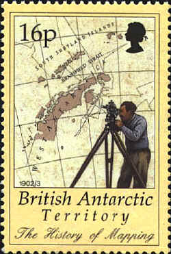
The 1902-1902 chart depicts the track of the Swedish
expedition vessel. It shows how little was known of the peninsula at
the beginning of the century. Theodolites were used to establish the
positions of prominent features.
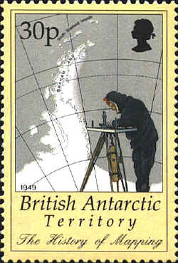
British
and American surveyors worked along the east coast of the peninsula
using plane-tables to produce the first modern map in 1949. The
eastern limit of the Larsen ice shelf was not well defined.
Aerial
photography improved the quality of mapping. All the ice shelves are
recorded on the map from 1964. Still, the coast south of 75° S is
badly defined. Tellurometers (radio distance instruments) were used to
measure distances

Satellites like Landsat meant that areas that had never been visited
could be viewed, and positions plotted. The 1981 map shows
improvements in detail and accuracy to 80° S.

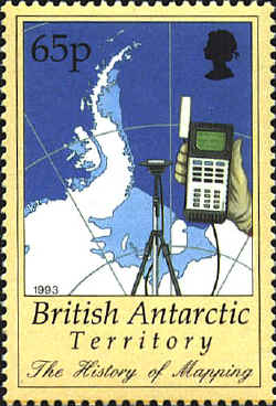
The
first seamless digital map of Antarctica, published in 1993, was
prepared by merging data from over 200 paper maps and satellite
images. Higher resolution satellite images and GPS produced greater
accuracy.


 |
