|
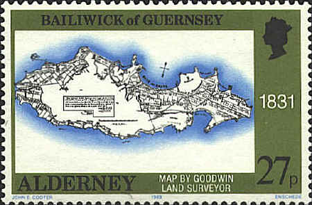
Goodwin
In 1830
it was agreed that the public lands of Alderney should be divided
among the families who lived there. Four lots were left over and they
were to be held until the 1831 census was taken "to give time for
those who may have been omitted to come forward." Left overs were to
be at the disposal of the Crown.
Someone was to be named as surveyor and "a book should
be kept to be deposited in the Greffe Office to be referred to in
future". The stamp shows a map by "Goodwin Land Surveyor" made in 1831
which seems to show the assignment of the lands.
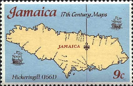
Edmund Hickeringill
Edmund
Hickeringill (1631-1705) published Jamaica Viewed in London in
1661. He was ordained by the Bishop of Lincoln in the same year. The
Oxford English Dictionary identifies the earliest use in
English of the verbal form of the word barbeque" in Jamaica Viewed.
Hickeringill was convicted of forgery in 1707. The map which was
included in the book was by Col. Edward D'Oyley, governor of Jamaica.

  |