|
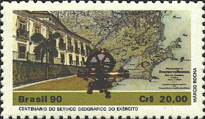
The stamp below commemorates the centenary of the
Serviçio do Geograpfico do Exército. The map is identified as
Distrito Federal Rio de Janeiro.
In 1810 and again in 1823
there were proposals to build a capital city for Brazil in the
interior, but it was not until the First Constitution of the Republic
was drawn up in 1891 that a specific proposal was included in Article
3 to set aside 14,4000 square kilometers in the Central Plateau for
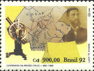
the new city. In 1892 the Commissão Exploradora do Planalto Central
was created. It was led by the astronomer, Luis Cruls. Two years later
the Cruls Quadrilateral was established as the site of the
future capital. In 1956 the name Brasilia was proposed, and
later that same year construction began on the provisional
presidential residency. In 1960 Brasilia was inaugurated, and the
Three Powers of the Republic moved to the city.
The spellings of place names on the map are not
contemporary and it is probable that the map was the work product of
Cruls' expedition. The red lines appear to be modern roads and
highways that serve Brasilia. The instrument on the left side of the
stamp also appears on the next stamp, while the tent points to the
hardships Cruls and his mission endured in identifying the site for
the Federal District.


 |