|
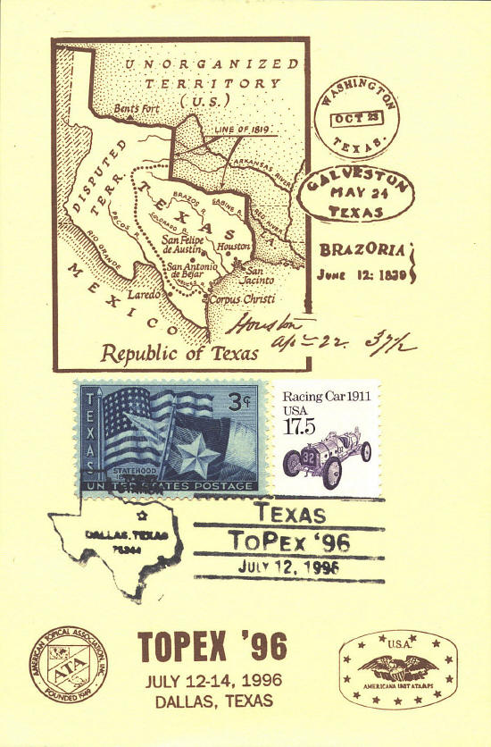
Republic of Texas ~ 1835-1845
In 1803 Thomas Jefferson
negotiated the treaty by which "Louisiana" was purchased from France.
The land had not been definitively explored; the boundary between
French and Spanish land claims had not been settled. United States SCN
327 shows a map of the Louisiana Purchase with the southern boundary
passing through Texas between the Sabine and Trinity Rivers on the
east and between the sources of the Pecos and the Canadian Rivers on
the west.
In 1819 Secretary of State John Quincy Adams and
Spanish minister Luis de Onis y Gonzales reached agreement on a
boundary between Spanish and United States territories. From east to
west it followed the Sabine River north from the Gulf of Mexico to
32°N, then due north to the Red River; along the river to 100°W, then
north to the Arkansas River; along the Arkansas River to its source
then due north to 42°N, and west to the Continental Divide in Wyoming.
This is the eastern boundary of the Republic of Texas on the card.
When the Republic of Texas gained its independence in
1836 Mexico disputed the western boundary. Texas claimed the Rio
Grande to its source, and then due north to 42°N. This is the
west-most boundary on the card. Mexico conceded a much smaller area
shown on the card by the line of dots.
In 1845 Texas voted to join the Union and was accepted
as a State. In 1848 the United States-Mexican War ended with the
Treaty of Guadalupe Hidalgo. In the Compromise of 1850 Texas ceded the
land outside its present boundaries.
 |