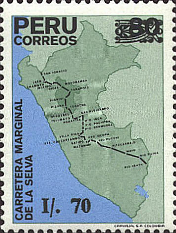
In 1989 Peru issued this stamp featuring a
map of Peru (in medium green) with the rain forest border highway
drawn from border to border. Also shown on the map are a number of
towns and cities along the highway, the Rio Abiseo National Park in
the darkest green near the top of the map, and Lake Titicaca in blue
at the bottom of the map.
The park was created in 1983 to protect the
fauna and flora of the rainforests. The park is also home to over 30
pre-Columbian archaeological sites. It has been closed to the public
since 1986 because of the fragile nature of both the natural and
archaeological environment.


|
