|
Malé Island
Malé (4°10'N 73°1'E) is the capital of the Maldives (which became the
Republic of Maldives in 1965). It is located on the island of Malé
(previously known as the Sultan’s Island) in the North Malé Atoll, in the
Maldives, an archipelago of approximately 1200 islands, of which 200
are inhabited. The island is 2km by 1km in size.
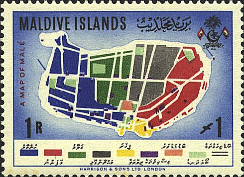
In 1961 the Maldive Islands issued three stamps with
the same design, a map of Malé which the Scott catalog says shows
population distribution. Because only the country of issue and the
words “A Map of Malé” on the left side of the stamps all the writing
is in Arabic script, including the color key to the map, it is unclear
what characteristic is being distributed (age, income, education). The
coat of arms of the Republic of Maldives is pictured in the upper
right corner.


 |