|
The map is of Iran. At the
bottom is the Persian Gulf, while the Caspian Sea is at the top. A
number of towns and cities are identified, and major roads between
them are indicated. The picture is of Muhammad Reza Shah Pahlavi,
Shahinshah of Iran.
The inscription in French reads, “In memory of Iran’s
contributions toward victory.” The victory is that of the allies in
World War II, and Iran’s contribution was to provide the route for
about 70% of Russian war relief. Iran was neutral at first, but in
1942 a treaty was signed with Great Britain and the U.S.S.R. to
provide nonmilitary assistance to the war effort. In 1949 President
Harry S Truman said, “Had not Iran opened its gates and given us the
opportunity to assist the Russians at the proper time, there is not a
doubt in the world but what the whole burden of World War II would
have eventually been on the United States of America.”
The stamp was issued in April 1949, two months after a
failed attempt on the Shah’s life by the Tudeh, the communist party in
Iran.

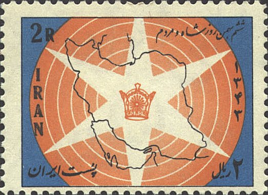
The stamp issued in 1965
marked the third anniversary of the Shah's six socioeconomic bills,
symbolized by the six-pointed star.
On the northern boundary
of the country on both maps the Caspian Sea is indicated. On the first
stamp by a sort of medallion with Arabic writing, on the second by two
lines extending North which indicate the East and West shores of the
Sea. At the South the Persian Gulf is indicated in a similar fashion.
Bahrain is the island in the Persian Gulf next to the penninsula of
Qatar. The island at the Straits of Hormuz at the East of the Persian
Gulf is Qeshum, which belongs to Iran.

 |
