|
Reunion 60
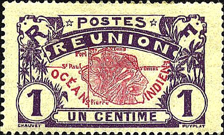
The stamp of Reunion issued as the first
stamp in a definitive set of 39 stamps in 1907. It features a map of
the island. The longitude given on the map is 53°E which is 2°20'
lower than the longitude based on the Greenwich prime meridian. But
this is not an error. The longitude is based on Paris as the prime
meridian. France did not accept the Greenwich prime meridian for
navigation purposes until 1914, which makes the longitude correct for
a French map.


 |
