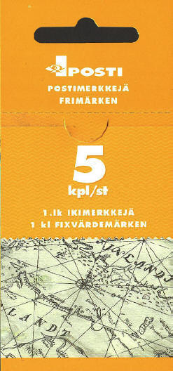
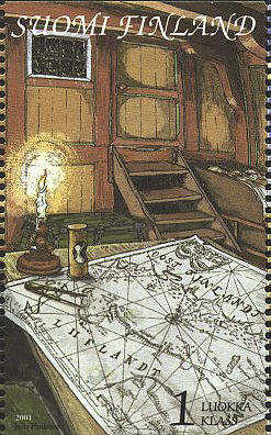
The chart of the Gulf
of Finland on the stamp and on the cover of the booklet was drawn
in 1676 by the Dutch publisher, Hendrick Doncker (1626-1699). For
about fifty years Hendrick Doncker ran a flourishing business in
Amsterdam as a bookseller and publisher of sea atlases and
textbooks on navigation. In a period when so many maps and charts
were simply copied from other publishers, Doncker's charts were
his own work and were noted for their accuracy and constant
improvement. Apart from this work, he cooperated for many years
with Pieter Goos and Anthonie Jacobsz in producing a pilot guide,
De Zeespiegel. Eventually his stock was sold to Johannes
van Keulen.
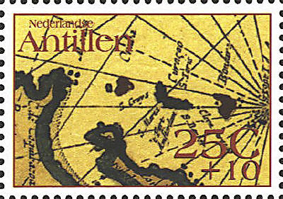
Two stamps issued by the
Netherlands Antilles show portions of De Carybsche Eylanden van de
barbados tot de bocht van Mexico toe nu eerst Uyt gegeeven door Arnold
Colom tot Amsterdam op het Water by de Nieuwe brugh in de Lichtende
Colom (The Caribbean Islands Newly Set Forth and Amended by Arnold
Colom, Amsterdam), 1656.
The chart by Arnold Colom was
re-issued by Hendrick Doncker in his De Nieuwe Groote Vermeerderde
Zee-Atlas in 1688.
Curaçao and Bonaire
St. Eustatuis


 |