|
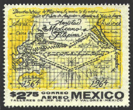
For over a hundred years
maps showed California as an island off he coast of the North American
continent, as in the map below.
P. Mark Anton Kappus
Slovenia issued two stamps to commemorate the 500th anniversary of the
discovery of America. The higher value depicts an unidentified old map
of the Gulf of Mexico with a dedication to Christopher Columbus.
The lower value shows an unidentified map of California
and Sonora with the image of a missionary and Indians. This
commemorates the work of the Jesuit missionary P. Mark Anton Kappus
(1657-1717) of Kamna Gorica who worked in the Sonora country (northern
Mexico) at the end of the 17th century and the beginning of the 18th
century.
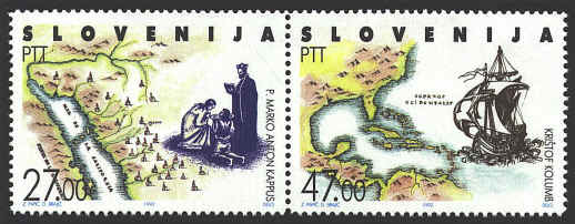
In a letter dated 8 June
1701 that Kappus sent to his friend Philippus Alberth in Vienna Kappus
was the first to report that California was not an island, as was
generally believed at the time, but rather a peninsula, and thus a
part of the North American continent.
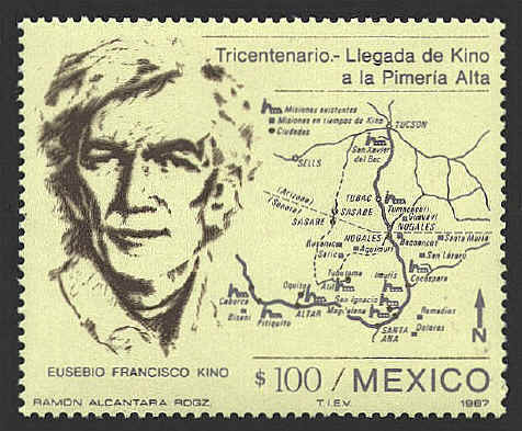
Fr. Eusebio Francisco Kino
Eusebio Francisco Kino (1644-1711) was a Jesuit
missionary, explorer, and director of the Spanish missions among the
Pima Indians. He arrived in New Spain in 1681 and established his
headquarters at Nuestra Señora de los Dolores in Senora. He founded a
number of missions in Primería Alta (present-day northern Senora,
Mexico and southern Arizona). His explorations of the mouth of the
Colorado River in 1701 convinced him that Baja California was a
peninsula, not an island as was believed by many. His map of the area,
drawn in 1705, was the standard reference map for more than a hundred
years.
For futher information on
Fr. Kino and his correction of the Island California error, see: Bill
Warren, "Map Maker on a Mission," Exploring Mercator's World: The
Magazine of Maps, Geography, and Discovery. 7:4(2002)24-35.
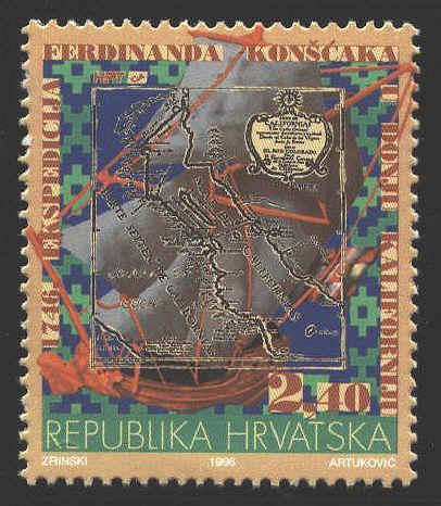
Ferdinand Konšćak
World-known explorer
Ferdinand Konšćak, son of a senior military
officer, was born in Varaždin in 1703. Determined to become a
missionary, he applied to the Jesuit general in Rome for six years,
asking to be sent to India. Finally he was chosen for Indian missions
in Mexico. Later he was sent to a mission in Lower California, and
from 1733 he spent 26 years at San Ignatio as a missionary, visitor
and superior, and also as an explorer-geographer. He organized and led
three major expeditions to explore the northern parts of Lower
California, in 1746 by sea, and in 1751 and 1753 by land. The
objective of the first expedition was to prove that Lower California
is a peninsula, which Konšćak did, and to find springs of fresh water
and pastures for further missions in the north. After the 1746
expedition he published a map of Lower California, as far as the mouth
of the Colorado in the Golf of California. This map was later included
in many books and was used until mid-nineteenth century as the
official American map.


 |
