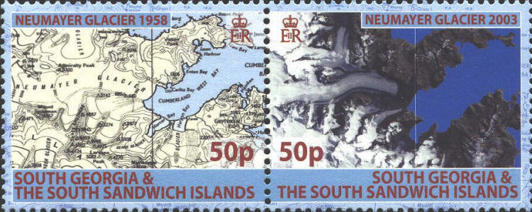
In 2005 the South Georgia Post Office issued a set of four stamps, two se-tenant pairs to commemorate the life of Duncan Carse the leader of the survey expeditions  on South Georgia in the 1950s for the British Antarctic Survey.
     The first pair of stamps features two maps, the 1958 map is the first detailed map of the island of South Georgia based on field surveys. It was used during the 1982 Falkland Islands conflict. The 2003 is based entirely on satellite information, the Landsat mosaic and Space Shuttle Radar Topography Mission data. The second stamp of the pair is a satellite map prepared by the Mapping and Geographic Information Centre (MAGIC) at British Antarctic Survey.

SCN 348

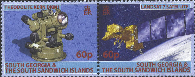
     The second pair of stamps feature a picture of is a Kern DKM1 that was used for a survey done in 1951-1952, and one of a Landsat 7 satellite that provided some of the data used in the new map.

SCN 349