|
Malagasy Republic 815
In 1987 the Malagasy Republic issued a set of six stamps featuring
several people associated with exploration and dates and locations of
events associated with Columbus' exploration of the New World. The
first stamp in the set honors Barthelemy Dias, and the departure of
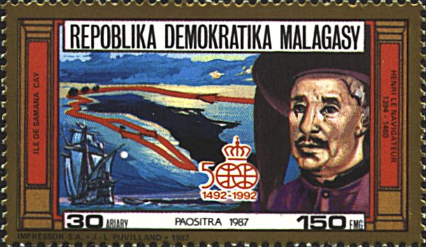
Columbus from Palos on August 3, 1492. The second, honors Henry the
Navigator (1394-1460) and has a map of Samana Cay, one of the islands
thought to be where Columbus made the first land-fall in the Western
Hemisphere on October 12, 1492.
The map on this stamp is based on one published in
National Geographic, November 1986, pp. 570-571. The caption
reads: "Samana Cay fits the description of the island that welcomed
Niña, Pinta and Santa Maria to what would become known as the New
World. The ships are shown, anchored where a reef opens on the southwest side
(the three black spots at the upper left of the island). In
rowboats Columbus explored the island he named San Salvador and
remarked on the geographic features and a large anchorage between the
reef and the island (red track of exploration, above) and then
departed. The identification of San Salvador has been hotly debated
for two centuries.... A National Geographic field party
later...identified features like those described in the log."
A question raised by the stamp is what connection there
is between Henry the Navigator and Samana Cay and Columbus.


 |
