|
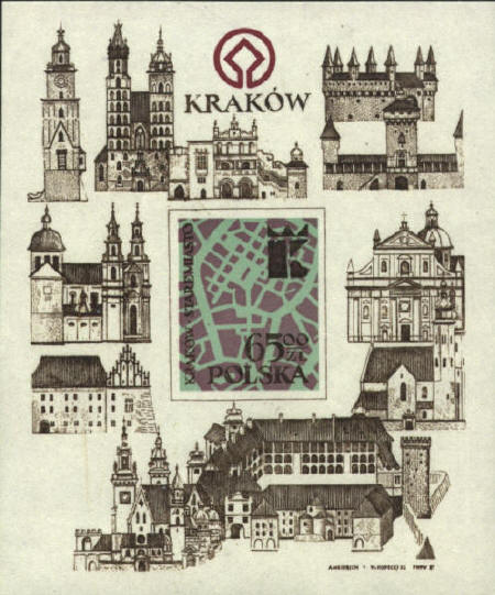
Krakow
Krakow was first mentioned
by a Cordoban merchant in 985 as a wealthy city on trade routes. It
became a part of the Polish state in the 10th century. The map on the
stamp shows the Staremiasto, the old town in Krakow. The modern map
shows the same area.
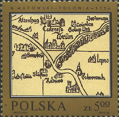
Bernard Wapowski ~ 1526
The first "modern"
map of Poland was compiled in 1526 and published in Marco
Beneventano's edition of Ptolemy's Geographiae, by Bernard
Wapowski, a canon and the King's secretary or treasurer. The map
covered the Kingdom of Poland and the Grand Duchy of Lithuania.
Because it seems unlikely that Wapowski would have developed all of
the information used to produce the map himself, some believe that
Nicholaus Copernicus (1473-1543) assisted him. It is known that
Copernicus had become interested in cartography about 1510, and that
in 1529 he made a map of the Prussian territories.
A possible reference to Copernicus' involvement is
hinted at by the portion of the map which appears on the stamp.
Copernicus was born in Torün, which appears in the center of the map
on the stamp.
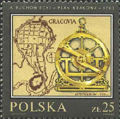
A. Buchowiecki ~ 1703
The map on the stamp, Plan
Krakowa, is by Andrzeja Stanisława Buchowiecki,
professor of mathematics in Cracow, 1703. The astrolabe is from the
17th century.
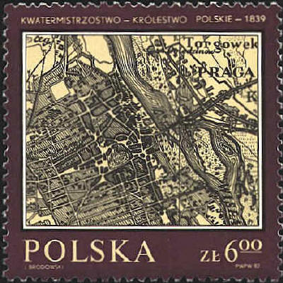
Warsaw ~ 1839
The
site of Warsaw was occupied as early as the 10th Century. In the third
partition of Poland in 1795 Warsaw was assigned to Prussia. It was
seized by Napoleon's army in 1806, and in 1813 it was retaken by the
Russians and incorporated into the Russian empire. The map is
identified as deriving from the "Polish Kingdom Quartermaster," 1839.
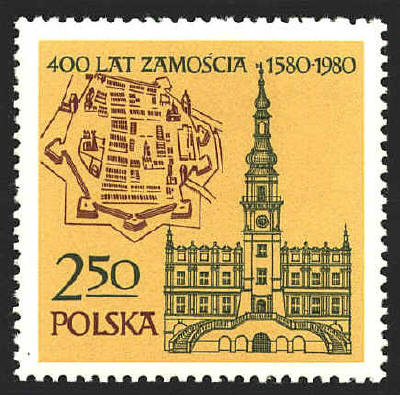
Zamosc ~ 1580
Zamosc, a stronghold and a historical monument, situated in the
South-East of Poland, was founded in 1580 by chancellor Jan Zamoyski.
According to 16th century standards, it is a splendid example of the
perfect town. The town was built in Italian Renaissance style and has
retained its original layout to the present day, constituting a town
planning system unique in the world scale.
Jan Zamoyski, a humanist educated in Padua, a patron of
literature, science and arts, wanted his town to be an authentic
masterpiece. He handed the realization of his dream over to Bernardo
Morando, a Venetian architect.
Town construction lasted several years, but it was
worth waiting for. A centrally located perfect square constitutes the
Great Market Place, which is based on the antique tradition of
forum publicum and is surrounded by Italian style arcades, which
used to house merchant shops and wine-shops. The tenement houses are
decorated with friezes, false fronts, reliefs, splendid portals,
frescos and polychromes.
The Market Place is dominated by the monumental Town
Hall with a grand staircase. A 16th c. Renaissance cathedral, the most
magnificent in Poland, is located nearby. In the cathedral, priceless
altars and paintings, like "Zwiastowanie Najswietszej Marii Panny"
("Annunciation of the Holy Virgin Mary") by Carlo Dolei or series of
paintings presenting life of St. Thomas, the patron of Zamosc, can be
seen. The cast silver tabernacle is famous throughout Poland .
The stronghold of Zamosc is famous for its
fortifications. In the past, the town was surrounded by fortified
walls with seven bastions and a moat. The fortifications proved
especially useful during the 1648 Cossack war and the 1656 Swedish
war. The fortifications were modified according to French military
arrangements and protected the town from the Russian Army in 1813 and
1831. Several gates were built into the walls, the most famous being
the Lubelska Gate.
The plan on the stamp is based on an engraving
by Abraham Hogenberg after the works of Georg Braun, "Theatrum
preciparum totius mundi urbium", 1618.
  |