|
Petrus Plancius (Pieter Platevoet, "Peter Flatfoot") (1552-1622) was
born in Flanders. He was a theologian and minister in the Dutch
Reformed Church. In 1585 he fled to Amsterdam to escape religious
persecution. There he became interested in navigation and cartography,
and became cartographer to the Dutch East India Company. In this
capacity he produced over 100 individual maps and charts. Although
some would characterize him as "a useful amateur," many see him as the
most important personality after Mercator at the close of the
sixteenth century. His work is not as well known as that of his
contemporaries because he did not publish an atlas.
In 1592 he published a world map Nova et exacta
Terrarum Tabula geographica and hydrographica, which is the basis
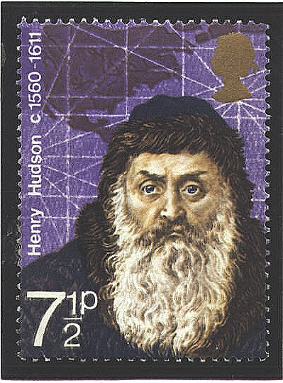
for the map in the background of the British stamp. Little of the
detail present on the map is shown on the stamp. That which is shown
is the St. Lawrence River system, and a part of an imaginary waterway
at the top which Plancius believed would provide a passage between the
Atlantic and Pacific Oceans.
He was a close friend of Henry Hudson (1560-1611) who
led two expeditions for the Muscovy Company and one for the East India
Company which were intended to discover a passage between the two
oceans by way of the North Pole. Hudson had reservations about a
polar passage, but he believed that a passage could be found in what
he called "my Furious Overfall." In 1610 he sailed into the Furious
Overfall, later named Hudson Strait. The crew mutinied and put him and
loyal members of the crew adrift. The map reflects many of the ideas
and fantasies connected with the search for a northern passage to the
Pacific.


 |
