|
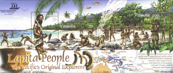
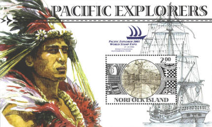
Souvenir sheets issued by
Vanuatu and Norfolk Island for the Pacific Explorer 2005 World Stamp
Expo in Sidney, Australia, commemorate the early peoples and
explorations in the Pacific.
The Lapita people are first documented in the Bismarck
Archipelago or Papua New Guinea around 1350 B.C. For the next 700
years they explored the Pacific as far as Fiji around 650 B.C. They
were displaced from Fiji by the Melanesians and went on to Western
Samoa and Tonga. Today their descendents are known as the Polynesians.
The sheet from Vanuatu shows a map of their
explorations.
The sheet from the Norfolk Islands is based
on the left-hand hemisphere of Vera Totius Expeditionis Nauticæ, a
double hemisphere map published by Jodocus Hondius in 1595.
The continents of North and South America and Europe-Asia-Africa are
divided between the two hemispheres. The continent of Australia is
misunderstood. The first English circumnavigation of the globe is
marked on the map. For a larger image of the whole map on postal paper
click here.

|
