|
In Mercator's projection
the size of land masses is sacrificed. It preserves the shape of land
masses and provides for plotting courses of constant direction. The
lines of longitude are straight vertical lines equal distance apart at
all latitudes, and horizontal distances are stretched above and below
the equator so that shape and direction are preserved.
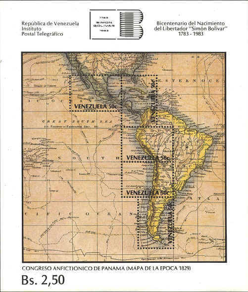
The souvenir sheet shows a portion of the "Chart of the
World on Mercator's Projection," from the General Atlas,
Edinburgh, 1821. It was issued to commemorate the bicentennial of the
birth of Simón Bolivar, 1783-1983.
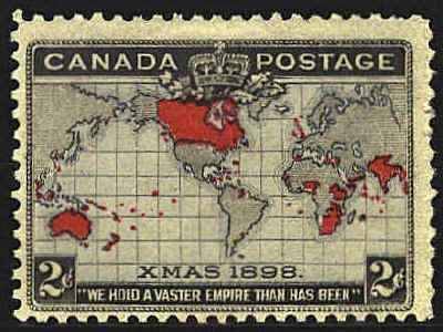
The Map
Stamp, the Canadian Christmas stamp of 1898 was the first
representation of the Mercator Projection on a stamp. The scale
is .1" to 1,973 miles.
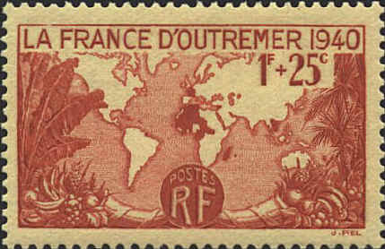
The French stamp shows
France's colonial possessions in 1940. The word "D'OUTRE-MER" is
misspelled "D'OUTREMER." It is spelled correctly on a postage stamp
(not semi-postal) with the same design issued in 1945.
The German stamp clearly
shows the horizontal stretching of latitude at the poles.

 
|
