Carved Wooden Map
In 2000 Kalaallit Nunaat
(Greenland) issued a stamp with a wooden man as a part of the
Cultural Heritage series.
"...wood was, and is, the most distinctive medium used
by the Greenland Eskimos in mapmaking. Blocks are carved in relief to
represent the rugged coastline of Greenland with its fjords, islands,
nunataks and glaciers, the shapes of the various islands being linked
together with rods. In order to reduce the size of the blocks, the
outline of the coast is carried up one side and down the other."
Leo Bagrow, History of Cartography. Revised
and enlarged
by R.A. Skelton. Cambridge, Harvard U. Press, 1960, p. 27
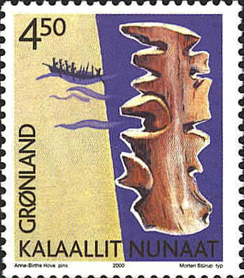
Three-dimensional maps of
coastlines were carved of wood as long as three hundred years ago.
These Inuit charts were usually carved from driftwood and are made to
be felt rather than looked at.
The land is very abstract. It is limited to "edges"
that can be felt on a dark night in a kayak. Since they are made of
wood they are impervious to the weather, and will float if there are
dropped overboard accidentally.
The map on the stamp is shown in Plate II of Bagrow's
book.
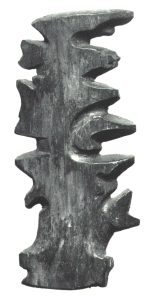
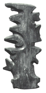
As it appears in the book.
Mirror Image
The stamp shows a map of Greenland and a
portrait of King Frederik IX of Denmark from 1947 to 1972.

