Peru 377
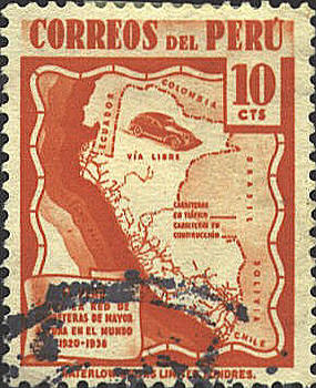
The map issued by Peru in 1938 shows the
territory of Ecuador greatly reduced, largely in keeping with Peruvian
claims on the territory. However, the map represents itself as a
"highway" map, so it is difficult to catagorize it as propaganda. On
this copy the legend on the banner in the lower left corner is
obscured, so no help can be had there. For now we will identify it as
a Border error.


 |