|
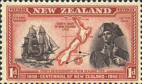
New Zealand 230
There are two errors on
the map that reflect errors in the original map. At the southern tip
of the South Island, Stewart Island is shown as a possible peninsula,
while off the east coast of the South Island, Bank's Peninsula is represented as an island.
What does not seem quite correct as a representation of
Cook's map are the latitudes that are marked. On the map 40° and 46°
are shown as lines, but on the stamp 45° is substituted for 46° and a
third line is added for 35°.
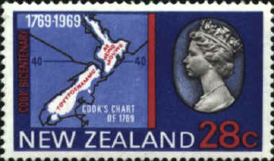
New Zealand 434, issued in 1969, shows the same source
errors concerning Stewart Island and Bank's Peninsula.
What is not an error is the longitude labeled 190°.
While today we label longitudes both east and west from Greenwich to
180°, that only began after the 1894 Washington Conference on the
Prime Meridian.
New Zealand 434


 |
