|
Netherlands Antilles 352-354
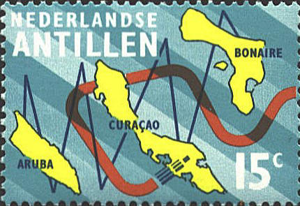
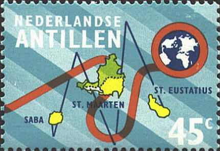
In 1973 the Netherlands
Antilles issued a set of three stamps and a souvenir sheet with maps
to celebrate the establishment of a cable link between the Antilles
and the islands of Saba, St. Maarten, and St. Eustatius over 560 miles
(900 km) to the northeast.
The islands in both groups are too close to each other, they are not positioned correctly in relationship to each other
within the groups, and they are not oriented correctly with respect to
North. Since the two island groups are shown on two
stamps, their relationship to each other in position and scale is not
in question.


 |
