|
Although maps can be drawn
without attention to elevation, high points have frequently been used
to determine location. With the development of countour mapping
altitude is plotted as well as latitude and longitude. One of the most
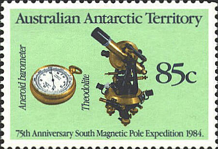
convenient ways to determine elevation of altitude is to use an
aneroid barometer with measures changes in air pressure. The barometer
can be calibrated to read directly in feet or meters above sea level.
The stamps shows a pocket aneroide barometer.
The other instrument measures vertical angles, and is
used as the astrolabe, quadrant, cross staff, back staff, and sextant
to measure the angle of a star above the horizon to determine
latitude.
 |