|
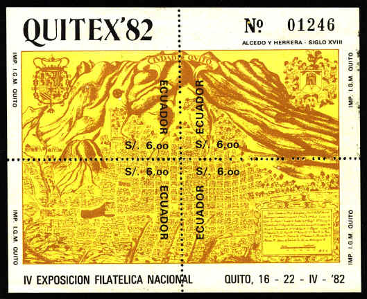
Quito ~ 18th Century
The
Quitu Indians lived on the site of Quito before the eleventh century.
In 1487 it became the northern capital of the Inca Empire. Ninety
years later it was captured by the Spanish under Sebastián de
Benalcázar. The Ecuadoreans won their independence from Spain in 1822,
and established Quito as their capital.
The map was drawn by the Don Dionisio Alcedo y Herrera
(1690-1777) ca. 1734. Dionisio traveled to America in 1706. He was
Presidente y Capitán General of Quito from 1728 to 1737. He
returned to Spain in 1752.
The sheet was issued to commemorate the Expositión
Filatélica National in Quito in 1982.
Cuenca ~ 1915
Santa
Ana de Cuenca was founded by the conquistador Gil Ramirez Davalos in
1557 on the ruins of the former residence of the Inca ruler Huayna
Capac. It lies in a mountain valley (cuenca) at an altitude of 8,512
feet on the Rio Matadero.
The map was drawn by Dr. Octavio Cordero Placios on the
basis of information from the official records of the founding of the
town in 1557. It was published by Dr. Palacios in his Miscelania
historica del Azuay in 1915. The stamp shows a portion of the map
centered around the plaza or public square in which stands what
appears to be a gallows. On the original the ownership of the various
lots is identified by the owners' names.
The arms of Cuenca are pictured on the right side of
the stamp.

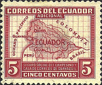
This Postal Tax Stamp,
which supports the Social and Rural Workers Insurance Fund, issued in
1938 shows a map of Ecuador and the surrounding areas.
 |
