|
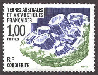
Before the compass was used in Europe to determine direction,
Scandinavian sea-farers used a "sun stone" to locate the sun, from
which they could estimate directions. It is not known with certainty
what the "sun stone was but some have suggested it was the mineral
cordierite or iolite. This mineral changes color when it
points toward the sun. Even after the magnetic compass was introduced
in the 12th century, navigators in the northern seas, where it was
inaccurate, continued to use the sun-stone.
The
lodestone was an early tool for determining direction. A lodestone is
a kind of iron ore called magnetite. Certain pieces of magnetite
possess the quality of pointing to the earth's north magnetic pole. To
begin with the lodestone was simply floated or suspended, and its
attraction observed. The stamp below shows a lodestone storage box.
The
first mention of the directional compass (as opposed to magnets
themselves) occurs in Alexander Neckam's De Naturis Rerum (On
the Natures of Things), probably written in Paris in 1190. By about
1218 Jacques de Vitry considered the compass as a necessity for
maritime navigation. By 1225 it was in use in Iceland. The mariner's
compass was in general used by navigators by the beginning of the 13th
century.

The
last examples are special purpose compasses. The prismatic compass
was invented by Charles Schmalcalder in the 19th century. It is
usually a small instrument which is held in the hand, The zero of the
graduations coincides with the south point of the needle and run
clockwise from the south end of the needle (0º to 360º), The prismatic
attachment consists of a 45º reflecting prism which enables the user
to see both the observation target and the graduations.
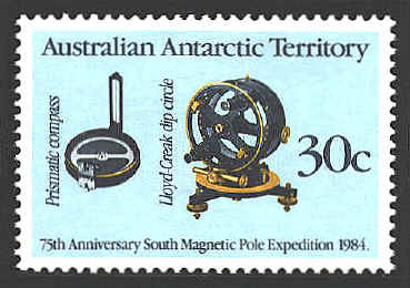
Unlike a
compass where the magnetic needle is placed horizontally to measure
the direction of magnetic north, the dip circle measures the angle of
the lines of magnetic force entering the earth's surface, the angle
between the horizon and source of the earth's magnetic field. It is
used to determine the location of the magnetic pole.
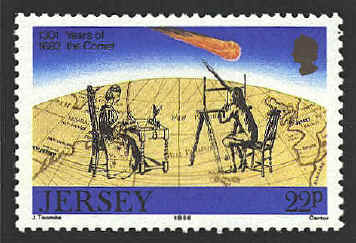
In
October 1698 Edmond Halley began the first of two voyages to gather
information on the "deflection of the Magnetical Needle from the true
meridian." He completed his second voyage in September 1700. In 1701
he published a map showing his findings. He described his map as
follows: "What is here properly new are the curve lines," that is, the
lines connecting points with the same divergence of the compass needle
from astronomical north. On a stamp issued by the Bailiwick of Jersey
in 1986 in commemoration of the return of Halley's comet, a map
adapted from Halley's map serves as the background.
Norman J. W. Thrower, "To Make Observations on the
Magneticall Needle: The Atlantic Voyages of Edmond Halley and His
Charts," Mercator's World January/February 2000, pp. 48-52.
 
 |