|
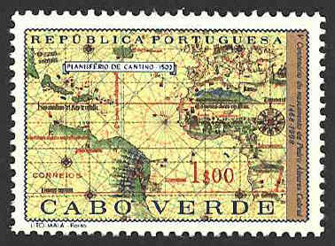
Ship's
logs and maps of exploratory voyages were highly prized in the
fifteenth and sixteenth centuries, and very secret. They were the key
to trade and treasure. The penalty for revealing such information to
foreigners was often death. In 1502 the Duke of Ferrara instructed his
agent, Alberto Cantino, to acquire information on the latest Portuguese
discoveries. Cantino paid twelve gold ducats for a copy of the
official Portuguese padron, the world map on which all new
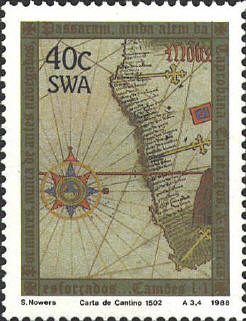
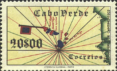
discoveries were recorded. It is called Carta de navigar per
le Isole nouam tr[ovate] in le parte de India: dono Alberto Cantino al
S. Duca Hercole (Chart of the islands recently discovered in
the regions of the Indies presented to Ercole d'Este, by Alberto
Cantino). The two horizontal red lines are the Tropics of
Capricorn and Cancer. The black line between them is the equator. The
vertical line labled in red is the Treaty of Tordesillas' line.

The chart covers 257° of
longitude, from the east coast of North and South America to the east
coast of China. It records the continent of Africa with great
accuracy, the demarcation line between Spanish and Portuguese
monopolies granted by the Treaty of Tordesillas, as well as flags and
descriptions of the voyages of Câo, Dias, da Gama and Cabral, and
indications of the natural and political history of some areas.
The
gold crosses on the west coast of Africa mark the locations of the
padrôes (stone pillars cut from Portuguese limestone) placed by the
Portuguese explorers, particularly Diogo Câo and Bartolomeu Dias.
After
being lost, the map was discovered in 1870 handing in a butcher shop
in Modena. It was restored and was placed in the Bibliotheca Estense
in Modena.


 |
