|
Although Danish by birth,
Vitus Jonassen Bering (1681-1741) spent most of his adult life in the
Russian navy. In 1725, shortly before his death, Peter the Great
instructed Bering to prove definitely that Siberia was separated from
North America and to find the nearest European settlement in the New
World.
During the First Kamchatka Expedition (1725-30), Bering
and his assistant lieutenant, Aleksei Chirikov (1703-48), sailed north
along the coast of Kamchatka, and in August 1728 passed between the
two continents. Convinced of the existence of a large landmass to the
east, the Russian government decided to form a second expedition that
would explore this territory.
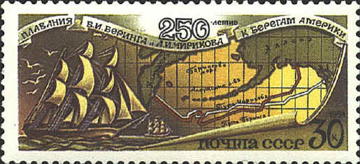
Bering's second voyage for Russia was made in 1741. Its
purpose was to explore and chart the western coast of North America.
Bering was also asked to determined the loaction of Gamaland, a large
land mass thought to lie in the vicinity of the Asian coast at 46° N.
Sailing in two ships, Bering and Chirikov landed at several places
along the Aleutian Islands and the coast of the North American
mainland between June and September 1741.
The map on the stamp shows the routes of Bering and
Chirikov with the white line representing Chirkov’s outbound route,
and the brown line representing Bering’s outbound route. The stamp was
issued for the 250th anniversary of the voyages of Bering and
Chirikov.
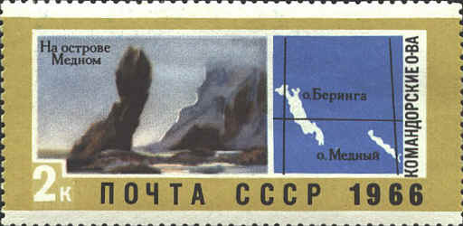
After
two attempts to locate the non-existent Gamaland Bering turned west.
He landed on a small island near Mt. St. Elias, and turned back toward
Asia. Bering's ship was forced to land on the largest island of the
Komandorship group. The crew was sick with scurvy. Bering was very ill
and did not recover..
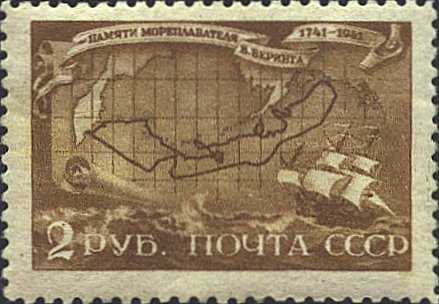
The map on the stamps below is based on one by Gerhardt
Müller was published in 1761 as Map of the Discoveries made by
Russians on the North-west Coast of America.” Bering’s routes,
corrected for errors in the old records, are shown on the map.

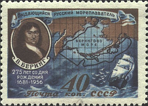
The
next stamps are modern charts of the second voyage.

 |